

Favorite Things to Do & Destinations Within ONP
Olympic National Park is on Washington’s Olympic Peninsula in the Pacific Northwest. The park sprawls across several different ecosystems, from the dramatic peaks of the Olympic Mountains to old-growth forests. The summit of glacier-clad Mt. Olympus is popular with climbers. Numerous hiking and backpacking trails cut through the park’s rainforests and along its Pacific coastline. The main park office, the perfect jumping off spot for exploring the park, is just 20 minutes away!

Marymere Falls
Marymere Falls are accessed along a well-maintained trail that heads south from the Storm King Ranger Station. Park at Lake Crescent. The trail winds through a moss-laden, fern-lined, old-growth lowland forest. It consists of fir, cedar, hemlock, and alder trees that provide a mystical and magical overhead canopy.
Dropping from a height of 119 feet through a notch in a tall cliff on Falls Creek, the waterfall plunges into a mossy “amphitheater”. There are two primary viewpoints . One from a ledge directly opposite the base of the falls. The other higher up the hillside looking down at the falls. The trail is approximately 1.8 miles round trip and is considered an easy hike. In fact, with assistance it is also an accessible hike to the lower viewpoint.
Give yourself plenty of time because you’ll want to stop frequently for photos. Although the falls are the destination, the hike is as beautiful and enchanting as the falls.
Directions: located approximately 45 minutes west of the Inn. Combine this hike with 2-3 other destinations for an enjoyable day trip. We’re happy to assist you in planning an exciting day trip just for you.
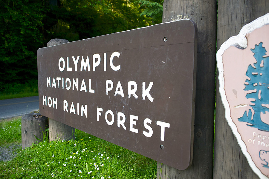
Hoh Rain Forest
The Hoh Rain Forest is located in the stretch of the Pacific Northwest rain forest which once spanned from southeastern Alaska to the central coast of California. The Hoh is one of the finest remaining examples of temperate rain forests in the United States. It’s also one of the park’s most popular destinations.
Start at the The Hoh Rain Forest Visitor Center, located at the end of the Upper Hoh Road. The staff there can give you ideas for your visit. The exhibits will help explain what makes this area so special. The visitor center is open daily during the summer. Closed December through early March. Open Friday through Sunday (generally) during the spring and fall seasons (hours may vary according to season.)
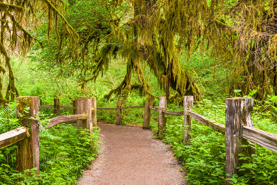
Two short nature trails loop through the forest near the Visitor Cente: Hall of Mosses Trail (.8 miles), and the Spruce Nature Trail (1.2 miles).
The Hoh’s major hiking trail is the Hoh River trail. It leads 17.3 miles to Glacier Meadows on the shoulder of Mount Olympus. The Hoh Lake trail branches off from the Hoh River trail after the ranger station and ascends to Bogachiel Peak between the Hoh and the Sol Duc Valley.
Several coastal areas within Olympic National Park, as well as the town of Forks, can be reached in less than one hour by car from the Hoh. Before you come, make sure to visit the Getting Around page for mileages to different park destinations.
Directions: The Hoh lies on the west side of ONP, about 2-hours from Port Angeles and under an hour from Forks. Access is via Upper Hoh Road, off Highway 101. A general map and information regarding facilities, picnic areas, camping, and regulations can be found on the park’s Hoh Rain Forest brochure.
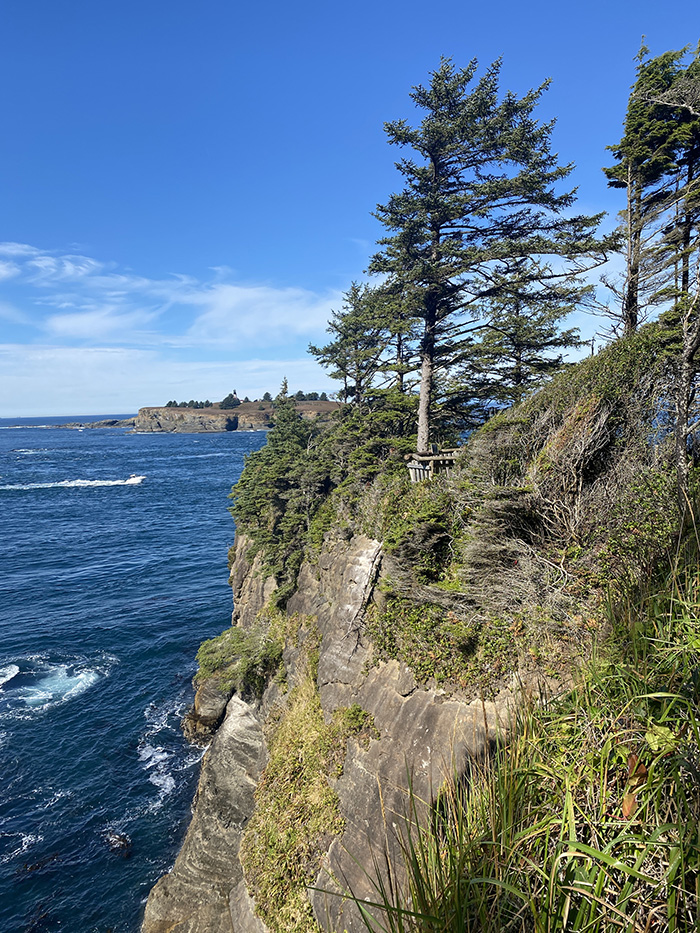
Cape Flattery Trail
From the tip of this scenic trail, you can view Tatoosh Island while standing on the most northwesterly tip of the contiguous lower 48 States. Four observation decks on the Cape Flattery Trail provide spectacular views of the rugged rocks, birds, and jade waters of the Pacific Ocean. The Pacific takes on many hues depending on the weather and cloud cover from steel gray to light pink or yellow at sunset. Watch for gray whales off the Cape and sea lions on Snake Rock just east of Tatoosh Island.
Trail Info: 0.75 miles from trailhead to overlook. A Makah Recreation Pass is required to park at the trail head.
Amenities: Restrooms, parking, picnic tables near the observation platform overlooking Tatoosh Island at the end of the trail. There are no garbage cans along the trail. Please pack out your litter.
Difficulty: Expect boardwalks, stairs, and dirt sections. There is an overall elevation loss of 200 feet. A moderate amount of exertion is required to get back to the parking lot.
Directions: From Port Angeles, drive Hwy 101 west for 5 miles. Turn onto Hwy 112 west and continue for 64 miles to Neah Bay. Continue on Bayview Ave for 1 mile, make a left on Fort St, right on 3rd St, and a left on Cape Flattery Rd. Drive Cape Flattery Rd to end, it becomes Cape Loop Road, 7.6 miles to the parking lot.
Additional ONP Info and Sites:
From the Pacific Coast, temperate rain forests, to mountains, old growth forests, lakes and streams – there’s adventure to be had throughout Olympic National Park. In addition to the sites mentioned above, additional favorites include those listed on the Places to Go in ONP page of the Olympic National Park Website.
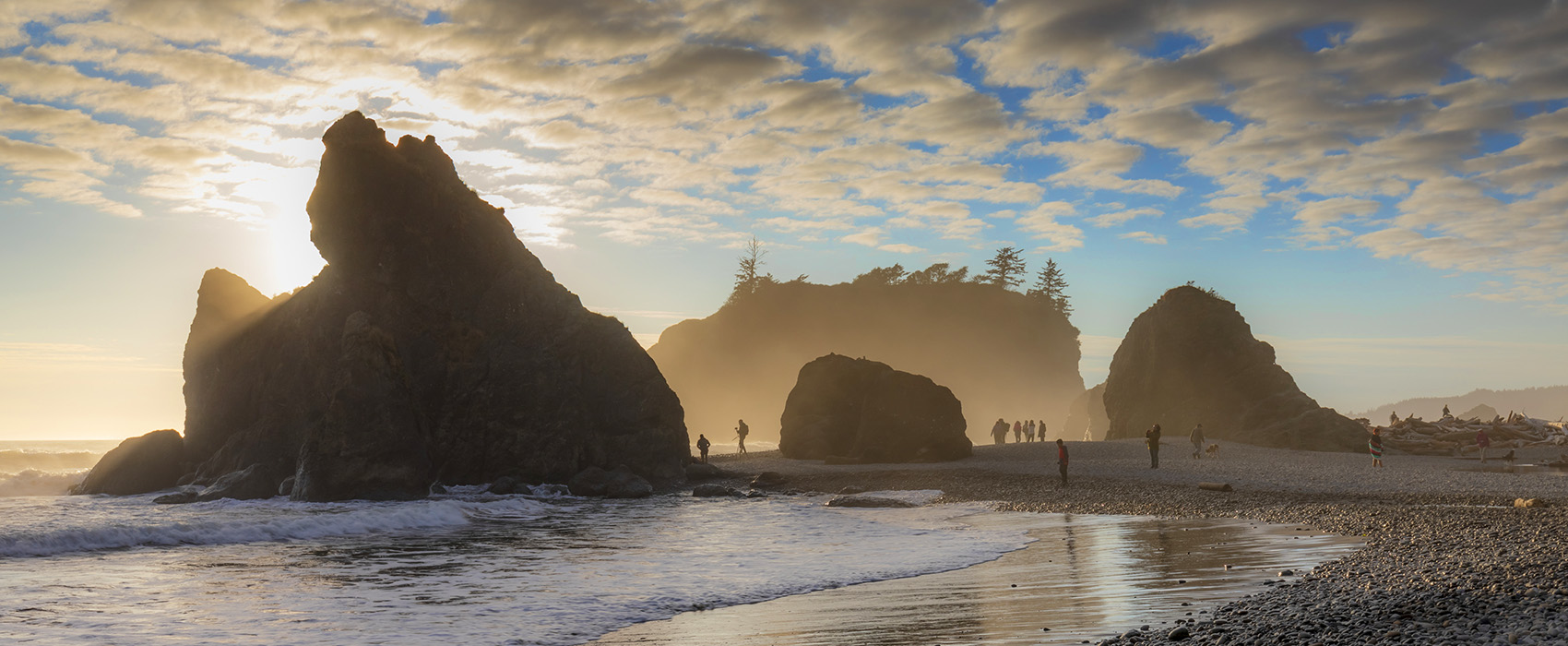
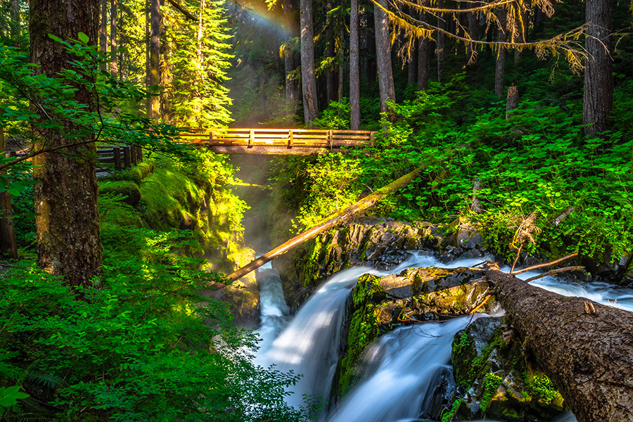
Pictured here is Sol Duc Falls. The page top image is of Ruby Beach.